Tracks 'Unmapping Trans Counter-Geographies'
On-the-move Autoethnographic Diary - Bart
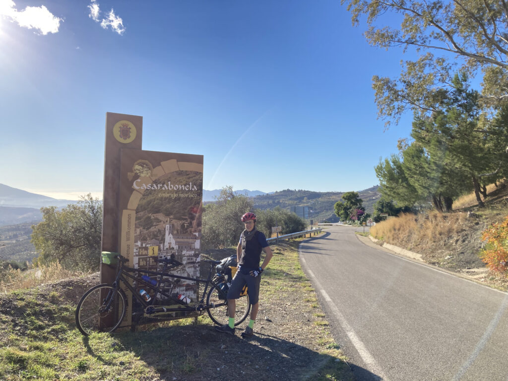
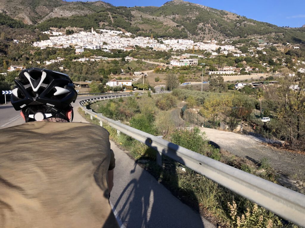
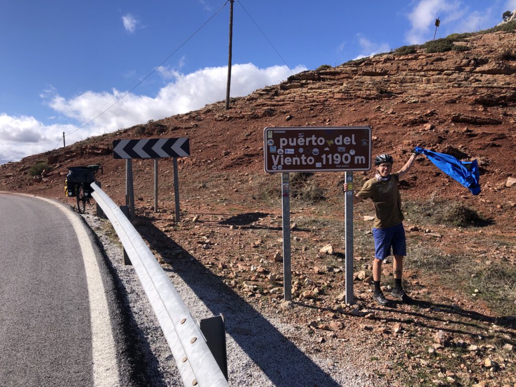
The first day we decided to take the train from Malaga to Pizarra, a village outside the city, in order to avoid the ugly outskirts of the city of Malaga. It was going to be a hard day, Malaga is one of the hilliest provinces of Spain – some argue that it is even the hilliest one, but this is another big debate –. We went through some pretty villages, such as Casarabonela, El Burgo, Ronda, Setenil de las Bodegas, and finishing in Olvera; we took a couple of avocados from a tree, that came with us until Mazagon because they were still quite green, and we climbed up ‘el Puerto del Viento’, a mountain pass called ‘the windy mountain pass’, which honored its name, with lots of chilly wind. A total of 95km and 1900m of accumulated height, without being able to stand up on the bike, we were just getting used to riding a tandem – Spoiler alert: Our butts hurt so much after the trip –. We put up our tent close to the village of Olvera, by the ‘Vía Verde’, the route we were going to take the next day.
Day 1: Pizarra - Olvera
Day 2: Olvera - La Atalaya
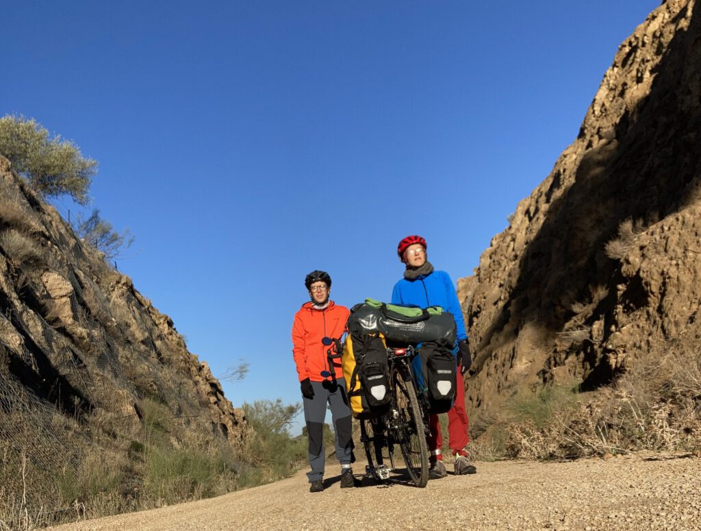
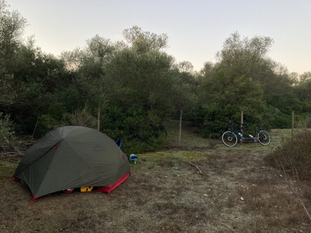
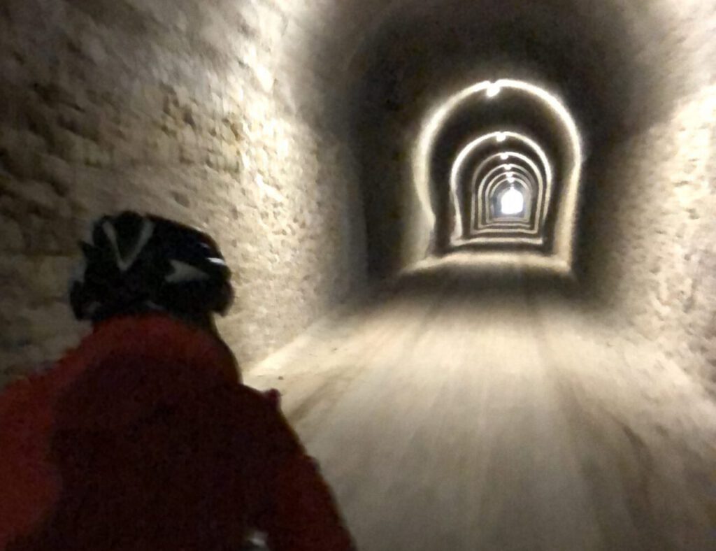
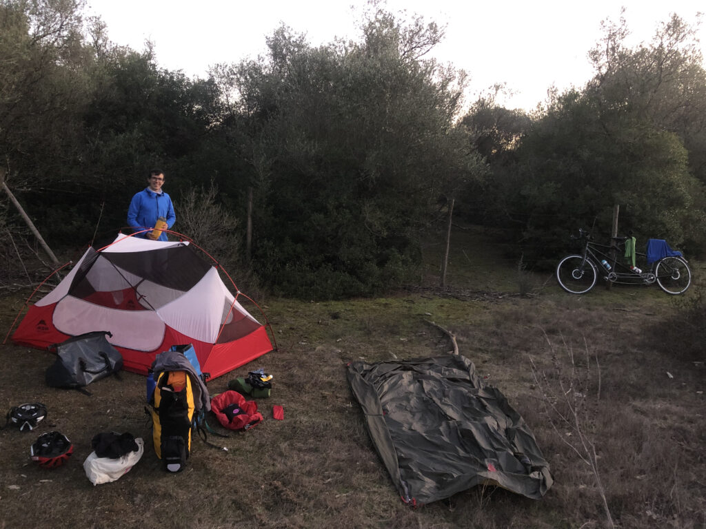
The second day started with a beautiful, and also very cold, ride on the ‘Vía Verde’. ‘Vías verdes’ are old train routes that have been conditioned as hiking/cycling/horse riding routes. Cars are not allowed in them, and they quite often have many tunnels. Sometimes we had to stop where it was sunny just to stay still and take the sun. We were always going a bit downhill in this first part of the route, and even though we were wearing 2 pairs of gloves we couldn’t feel our fingers. We went out of the Vía Verde in Coripe, a little village where we had a second breakfast at the bar of the pensioners’ home; they always have good breakfast at a cheap price. The old people who were there das a whole argument about what was the best road for us to take, but we decided to continue with our plan, as sometimes people think about the best roads for cars, but riding a bike is completely different; we love small roads with lots of curves. We did a total of 102km and 500m of accumulated height, but we had quite a strong headwind during a long part of the route. We found a cute place to put up our tent, far away from the roads. While we were cooking our last dinner – of the trip – we run out of gas, so we ate some part-boiled couscous with semi-dried vegetables. At least it was edible.
Day 3: La Atalaya - Bonares
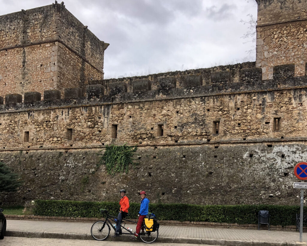
On the third and last day we did 91km and 540m accumulated height. The day started with a ferry – that we were not sure if it existed, but Google Map showed it – to cross the Guadalquivir river, one of the longest rivers of Spain. The ferry was there, and it took less than three minutes to cross the river, we did not even have time to take a photo. The next kilometers until Aznalcázar went through an old road through the middle of the Natural Park of Doñana. Doñana has some areas designated as National Park since 1967, and the surrounding areas as Natural Park since 1989. It is a quite unique natural area that is being devastated by the human being through (illegal and legal) overexploitation of its resources and human-caused forest fires. 8 kilometers before Bonares, my partner’s village, there is the village of Niebla, which has a quite famous castle. I had never been there, so we decided to visit it and take a last break before arriving. We didn’t want the trip to end so soon. IT looked like rain was coming, a small rain cloud had already discharged, so we waited for it to end and took the bike. Just 4km before it started raining again, even harder. It didn’t matter our shoes were waterproof, the water came in from above, feeling our feet like swimming inside a boat. We arrived completely soaked but happy to have our first shower in three days.